

Key Takeaways
Treat Atlantis as a lost-civilization hypothesis, not settled history
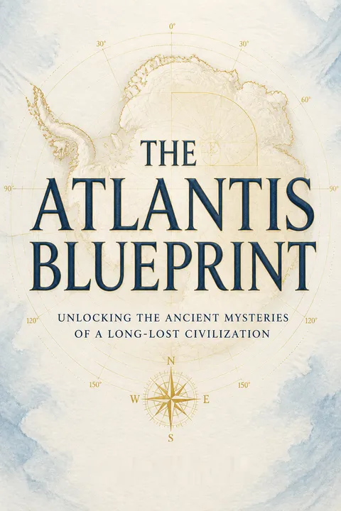
A deathbed clue starts the quest. In 1982, Rand Flem-Ath received a letter from geographer Charles Hapgood proposing that a shifting Earth’s crust had destroyed civilizations in the Americas and Antarctica. Hapgood died before explaining the evidence, prompting Flem-Ath’s investigation. The book’s central proposal is that Atlantis was an advanced maritime civilization based in Antarctica, which was warmer before a major crustal shift around 9,600 BC.
A bold synthesis, not a finding. The authors connect this catastrophe model to ancient maps, sacred sites, myths, and monuments, arguing that survivors preserved knowledge around the world. Plato’s story supplies a possible historical memory, they suggest, rather than merely a legend. Their interpretation is imaginative, but its evidence does not establish that Atlantis existed or that Antarctica was its home.
The narrative works because it begins with a specific unanswered question rather than a grand conclusion. That makes the reader feel the pull of investigation while leaving room to distinguish curiosity from proof. The proposed civilization also offers an unusually broad lens for connecting geography, mythology, and archaeology. Yet a powerful synthesis can be seductive: once many anomalies are placed inside one story, the story may seem stronger than the independent evidence warrants. The most useful stance is neither reflexive dismissal nor credulity, but asking what observation would distinguish this hypothesis from competing explanations.
Read ancient maps as clues, but separate accuracy from provenance
Maps drive the argument. Charles Hapgood studied charts such as the 1513 Piri Reis map, which depicts parts of South America and what he interpreted as Antarctica, and a 1531 map by Oronteus Finnaeus that appears to show the Antarctic coast. Hapgood argued that the maps drew on much older source charts, possibly made when parts of Antarctica were ice-free. He also noted that the Piri Reis map contains errors, including a duplicated stretch of coastline.
A map cannot date itself. The authors treat these charts as evidence for ancient navigators with advanced surveying skills. Their account of the Hadji Ahmad map, which appears to join Asia and Alaska, is another proposed clue to a much earlier source. But a map’s resemblance to a modern coastline does not by itself reveal when, where, or by whom its source was made.
Cartography is a form of compressed argument: every map reflects choices about projection, sources, and what counts as a coastline. Comparing old charts with modern geography can generate valuable questions, especially when the charts contain unexpected detail. The crucial next step is provenance, the chain of evidence connecting a surviving map to its alleged source. Without that chain, apparent precision can support several explanations, from inherited observations to copying, interpretation, or coincidence. The book’s map comparisons are most compelling as prompts for archival and technical investigation, not as standalone proof of a vanished global culture.
Test sacred-site patterns against fixed coordinates before calling them a blueprint
A global grid is proposed. Flem-Ath’s Atlantis Blueprint is his name for a claimed pattern linking ancient sites to former positions of the poles. He identifies recurring “sacred latitudes,” such as 0, 5, 10, 12, 15, 30, and 45 degrees, and says many sites fall within about 30 nautical miles of them. The pattern includes places as distant as Giza, Jerusalem, Easter Island, and Lhasa.
The pattern suggests a lost survey. The authors propose that ancient geologists or navigators marked key locations before a catastrophe, and that later cultures built sacred structures on those markers. They interpret sites related to the Hudson Bay and Yukon poles as traces of an earlier geographic system. This is a framework for organizing their evidence, not a verified archaeological method or an accepted account of pole movement.
The blueprint’s strength is its attempt to turn scattered sites into a question that can be checked geographically. Its weakness is the risk of selection effects: with many possible sites, pole locations, latitude bands, and error margins, striking matches can emerge without a shared ancient plan. A rigorous test would specify the rules in advance, include sites that do not fit, and compare the results with randomly chosen locations. That approach need not diminish the idea. It would clarify whether the pattern is genuinely predictive or mainly persuasive after the fact.
Use Giza as a test point, not a universal measuring stick
A prime meridian becomes the key. In 1884, astronomer Charles Piazzi Smyth argued that the world’s prime meridian should pass through the Great Pyramid; the conference chose Greenwich instead. Flem-Ath later used Giza’s longitude as a reference and found sites at apparently neat intervals. Tiahuanaco, for example, is roughly 100 degrees west of Giza, while Quito is about 110 degrees west. He also identified Lubaantum in Belize near a proposed 120-degree line and a latitude he associated with the Golden Section.
The pattern creates predictions. Flem-Ath used these alignments to suggest that further sacred sites might lie at particular coordinates, including lost locations in Brazil. The method is appealing because it can direct a search. But the number of sites, lines, and tolerances matters: a pattern becomes persuasive only if its rules are fixed before a candidate site is selected.
This section turns a historical disagreement about longitude into a practical search strategy. That is a genuine intellectual move: a theory becomes more valuable when it tells researchers where to look, not only how to reinterpret what they already know. The challenge is to prevent the reference point from becoming a flexible ruler. Coordinates should be calculated consistently, and proposed sites should be checked independently, ideally without choosing the most favorable among many possible alignments. Predictive success would give the blueprint more weight than an expanding catalogue of matches.
A flame that allegedly vaporizes tungsten demands replication, not mythology
Anomalies invite investigation. The authors recount the Libyan Desert glass, a large deposit of silica-rich glass discovered in Egypt. Its origin remains puzzling in their account: researchers found no nearby impact crater, while some pieces appeared to have been handled while molten. Engineer John Dolphin suggested that the glass might reflect extreme heat, even speculating about ancient atomic technology. The book also describes Yuli Brown’s gas, a mixture of hydrogen and oxygen said to melt materials while producing a comparatively cool flame.
The interpretation outruns the demonstration. The authors connect such claims to ancient metalworking, gold refining, and carvings at Tula that they read as images of flame-producing tools. They acknowledge uncertainty about the gas’s temperature and how its effects work. Neither the glass nor the demonstrations establish atomic power or a lost industrial civilization; the proposed explanations require independent measurement and replication.
An unexplained material is scientifically interesting precisely because it narrows the next question: what process could have produced its observed properties? That is different from choosing the most dramatic explanation. In the Brown’s Gas account, a reported low flame temperature alongside apparent high-temperature effects calls for careful instrument calibration, controlled comparisons, and repeatable tests. Likewise, unusual objects in ancient art can support multiple readings. The section is strongest when it preserves the anomaly and weakest when it lets mystery stand in for evidence of a specific technology.
Take ancient seafaring seriously without assuming one worldwide culture
The authors assemble routes across oceans. They interpret Costa Rica’s polished stone spheres and their groupings as possible navigation markers. They also cite Japanese-style pottery found in Ecuador, similarities between Meso-American and Asian traditions, and the advanced calendars of the Maya. A 1997 discovery of stone tools on Flores is presented as evidence that Homo erectus crossed water to reach the island, a claim the authors use to extend the history of seafaring far into prehistory.
Contact does not prove common origin. These examples support the possibility that people and ideas moved across seas earlier than once assumed. The book goes further, proposing a deep maritime network that transmitted knowledge between distant civilizations. Each example, however, has its own dating and interpretation problems. Evidence for one voyage or cultural contact does not by itself establish a single global civilization.
The discussion usefully challenges the assumption that ancient people were incapable of long-distance travel. Navigation can emerge from accumulated local knowledge, and objects or ideas can move through repeated contacts rather than one spectacular expedition. This distinction matters: diffusion is a set of possible pathways, not a shortcut to a single source civilization. Similar forms may result from contact, shared practical constraints, or independent invention. The case grows more convincing when routes, dates, and material evidence converge for a particular connection, rather than when resemblance alone is treated as proof.
Read Enoch’s measuring angels as a hypothesis about ancient surveying
A religious text becomes a field report. In the Book of Enoch, heavenly beings carry long measuring cords toward the north. Christian and Barbara O’Brien interpret the passage as a description of surveyors measuring land and studying the Earth. They connect it to the Kharsag epic, a fragmentary Mesopotamian text they read as an account of a settlement called Eden, built by unusually knowledgeable civilizers. The authors then propose that these figures left markers at sites later treated as sacred.
A second instrument enters the story. Christopher Knight and Robert Lomas describe “Uriel’s machine,” a proposed prehistoric arrangement of posts for tracking celestial movements. They suggest it could have helped predict danger from comets; Flem-Ath speculates that it may have monitored changes within the Earth. These readings link myth, astronomy, and geology, but remain interpretations of texts and structures, not demonstrated instruments.
Myth can preserve cultural memory, but interpreting it requires care because metaphor, ritual, and historical description can overlap. The measuring-cord passage gains interest from its concrete image and from the wider ancient practice of surveying land. Still, a text describing measurement does not identify the measured territory or prove a global project. The “Uriel’s machine” proposal similarly becomes testable only when its proposed functions match the structure, its dating, and independent archaeological evidence. The productive question is not whether a myth is literally true, but what evidence could discriminate among plausible readings.
Separate Templar history from the much larger secret-history narrative
A village mystery opens a long trail. In Rennes-le-Chateau, village priest Berenger Sauniere became wealthy after discovering coded parchments during church repairs. The authors connect the mystery to local geometry, the Knights Templar, and the Priory of Sion, a purported secret order. They also describe claims that the Templars excavated beneath Jerusalem’s Temple and found ancient texts that influenced Freemasonry and later religious traditions.
The connections are not equally secure. The Templars were a real medieval order, and their arrest in 1307 and the execution of Grand Master Jacques de Molay are historical events. Claims that they found Essene scrolls, that the Turin Shroud bears de Molay’s image, or that Sauniere guarded a suppressed Christian secret are far more speculative. The book’s narrative gains momentum by linking these episodes, but each link needs its own evidence.
Secret-history narratives often begin with genuine gaps in the record, then connect them through a sequence of increasingly interpretive claims. That structure can make a story feel cumulative even when its links vary greatly in strength. Here, a useful reading practice is to separate documented events, plausible inference, and conjecture rather than accepting or rejecting the entire chain at once. The Templars’ political history remains compelling without requiring every proposed hidden doctrine to be true. Clear labels for evidence levels make the mystery more, not less, interesting.
Look beneath Antarctic ice only where the blueprint makes a precise prediction
The final claim returns to the ice. Flem-Ath proposes that modern humans may once have lived in temperate regions of Antarctica and that some survivors carried knowledge elsewhere after catastrophic changes. He points to a satellite image of a circular feature beneath the West Antarctic ice sheet, near the Whitmore Mountains, and suggests it could be the lost city of Atlantis. The proposed location falls near a latitude he associates with the Yukon Pole and the Golden Section.
A lead is not a discovery. The feature has not been established as a city, and the book offers no excavation or independent confirmation. Its value is therefore as a sharply stated target for investigation, not as proof of the destination. The authors’ broader legacy is a call to revisit assumptions about ancient knowledge while testing extraordinary claims against physical evidence.
This is the book’s clearest opportunity to move from interpretation toward empirical testing. A buried structure could be assessed through repeatable imaging, geological analysis, and comparison with known natural formations, provided the methods and criteria are specified in advance. Such work is demanding, but that is exactly why a precise prediction matters. The idea should not be dismissed merely because it is unconventional, nor promoted as fact because a satellite image looks suggestive. The most productive outcome is a test capable of ruling the proposal in or out.
Analysis
The Atlantis Blueprint is a hybrid of intellectual biography, alternative history, travel narrative, and speculative synthesis. Its narrative engine is a chain of clues: Hapgood’s final letter prompts Flem-Ath’s search; maps and monuments suggest a hidden geography; myths and medieval orders are recruited to explain how knowledge might have survived. The result is less a conventional history than a hypothesis-generating map of relationships.
Its most useful contribution is the insistence that ancient societies deserve serious attention as navigators, surveyors, engineers, and observers of the sky. The book’s examples invite readers to ask how knowledge traveled, why sacred places recur, and whether modern categories have obscured complex ancient practices. Its stories also show how a research question can grow through archives, chance encounters, and collaboration.
The central weakness is evidentiary compression. The authors often move from an observation, such as a map resembling a coastline or a monument lying near a geometric interval, to a large historical conclusion about a global civilization. Those are different levels of claim. The proposed pole shifts, Antarctic civilization, advanced technologies, and Templar discoveries require independent evidence that the book does not supply. In particular, coordinate patterns need controls against site selection, flexible margins, and the many possible comparisons available across the globe.
A strong reader can preserve the book’s curiosity while separating its claims into layers: documented history, open archaeological questions, and conjecture. That approach does not flatten the narrative. It makes the narrative more useful by turning its most dramatic assertions into research questions with possible tests. The enduring value is not that Atlantis has been located, but that the book dramatizes how evidence, imagination, and confirmation bias can become entangled when a compelling master story gathers many anomalies under one roof.
Review Summary
The Atlantis Blueprint receives mixed reviews, with ratings ranging from 1 to 5 stars. Readers find the book's theories about ancient civilizations and Atlantis intriguing, but some criticize the authors' methodology and lack of scientific rigor. Supporters praise the book's open-mindedness and thought-provoking ideas, while critics argue that it relies on debunked theories and conspiracy thinking. Many readers appreciate the book's exploration of alternative historical perspectives, even if they don't fully agree with its conclusions. The writing style and organization receive both praise and criticism.
Glossary
Atlantis Blueprint
Proposed global site patternRand Flem-Ath’s name for a proposed network of sacred and ancient sites whose locations, he argues, correspond to former positions of the Earth’s poles, selected latitudes, and the longitude of Giza. He interprets the pattern as evidence of ancient geographic surveying and a lost civilization. The proposed network and its historical explanation are not established findings.
earth crust displacement
Proposed rapid crust movementCharles Hapgood’s hypothesis that the Earth’s outer crust could shift as a unit over deeper layers, changing the geographic positions of continents and poles over a relatively short period. The book uses this idea to explain climate changes, extinctions, and Atlantis traditions. It is distinct from the accepted theory of plate tectonics and is not an established explanation for these events.
Giza prime meridian
Giza-based longitude referenceThe proposed use of the Great Pyramid’s north-south longitude line as a global reference meridian. Astronomer Charles Piazzi Smyth advocated making it the world’s prime meridian in the nineteenth century, but the international conference chose Greenwich. Flem-Ath later used Giza as a reference for identifying regular longitude intervals between ancient sites.
sacred latitudes
Recurring latitude bandsFlem-Ath’s term for selected latitude values, including 0, 5, 10, 12, 15, 30, and 45 degrees, near which he says numerous sacred sites can be grouped when calculated against proposed former pole locations. He interprets the recurrence as evidence of ancient surveying. The results depend on site selection, coordinate choices, and accepted margins.
Uriel’s machine
Proposed prehistoric sky trackerChristopher Knight and Robert Lomas’s proposed name for a prehistoric arrangement of posts or stones used to track celestial movements. They suggest such a device could have helped observers monitor the sky and anticipate possible catastrophes. Flem-Ath extends the idea to monitoring geological change. The book presents these functions as hypotheses, not confirmed archaeological conclusions.
Download PDF
Download EPUB
.epub digital book format is ideal for reading ebooks on phones, tablets, and e-readers.