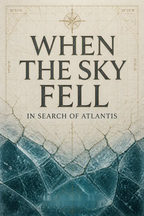


Key Takeaways
Consider Antarctica the authors' proposed Atlantis, lost beneath ice 12,000 years ago
A startling identification. Rand and Rose Flem-Ath argue that an advanced seafaring society lived on ice-free parts of Antarctica before a catastrophe around 9600 BCE. A rapid shift of Earth's crust, they propose, brought earthquakes, floods, abrupt climate change, and a new ice cover that buried the civilization. Survivors carried fragments of its knowledge and story to other regions. The book connects this claim to Plato's Atlantis, worldwide flood traditions, changes in agriculture, extinct mammals, and old maps that appear to show unknown lands.
A theory, not a discovery. The case is cumulative: no single clue establishes that Atlantis existed in Antarctica. The authors present a sweeping reinterpretation of disputed evidence, and the book's central promise is that one ancient disaster can explain many otherwise separate mysteries.
The appeal lies in its scale: one dramatic event links geology, archaeology, myth, and cartography, giving scattered puzzles a memorable shape. That same breadth raises the evidentiary bar. A theory that explains many things after the fact can seem powerful even when the evidence is ambiguous or selected to fit it. The key question is whether the Antarctic hypothesis makes distinctive predictions that competing explanations do not. The authors invite readers to imagine a lost chapter of human history, but the imaginative force of a story should not be mistaken for confirmation of its historical claims.
A shifting crust could unify disasters, but Einstein's interest is not proof
Hapgood's proposal. The book builds on Charles Hapgood's theory of earth crust displacement. It suggests that Earth's outer shell can shift as a whole over the deeper interior, moving continents into new climate zones while leaving the planet's rotational axis essentially unchanged. The authors distinguish this proposed sudden movement from plate tectonics, which explains the slower motion of individual plates. They imagine such a shift producing earthquakes, tsunamis, changing ice sheets, and sudden regional cooling or warming.
Einstein's role. Albert Einstein corresponded with Hapgood and found the idea worthy of consideration. The book treats this support as an important endorsement, but Einstein's interest is not experimental verification. The proposed mechanism, including how the crust could move so rapidly, remains the crucial question.
The book's unifying ambition resembles a useful scientific move: connect observations that have been divided among disciplines and ask whether they share a cause. But unity is not the same as validity. In modern geophysics, plate tectonics and other established processes explain crustal motion without requiring the whole shell to lurch suddenly across the interior. A proposal of global displacement must therefore show a physically workable mechanism and leave evidence that cannot be explained by known processes. Einstein's openness demonstrates that a question can be worth examining; it does not transfer the authority of physics to the answer.
Treat mammoth extinctions as a climate puzzle, not a solved case
The frozen evidence. The book opens its extinction argument with mammoths found preserved in Siberian ice, including a carcass discovered by ivory hunter Ossip Shumakhov in 1799. The authors ask how large herds could have lived in regions that are now barren, and how animals could have been frozen with flesh and hair intact. They also point to late Ice Age extinctions across North and South America, Australia, and Arctic regions, arguing that the uneven geography of losses fits their proposed crust shift.
A competing explanation. The authors challenge the overkill hypothesis, which attributes some extinctions to human hunting, because it does not explain every region or earlier extinction. They argue that climate change offers a wider explanation. Their specific cause, however, depends on the disputed crust displacement theory.
The strongest feature of this section is its insistence that extinction patterns vary by place and deserve more than a single universal explanation. Climate, habitat change, human hunting, and interactions among them can all matter, with different weights in different regions. The book is right to resist treating one cause as automatically sufficient. Yet a compelling puzzle does not validate any proposed solution: mammoths can be preserved by permafrost, and extinction timing and causes require site-specific evidence. The most productive legacy of the question is not a premature verdict, but a demand to compare mechanisms against the actual geographic and chronological record.
Look to highlands to understand why farming appeared after the alleged flood
Farming after upheaval. The authors connect the beginning of agriculture, which they place around 9600 BCE, to survivors rebuilding after a worldwide disaster. They draw on botanist Nikolai Vavilov's identification of crop-origin regions and emphasize that many lie in highlands, often above 1,500 metres. In their account, mountain settlements offered refuge from floods and preserved the plants and skills needed to cultivate food.
Three proposed refuges. The book highlights the Lake Titicaca region, where potatoes and llamas were domesticated; Thailand's highlands, associated with early rice cultivation; and Ethiopia's highlands, associated with millet. It also links the later spread of farming and early civilizations to climatic changes. The timing and geography support the authors' story, but do not by themselves demonstrate a lost civilization or a common cause.
The focus on altitude adds a useful spatial question to the story of agriculture: where were people, plants, and animals able to thrive as climate changed? Archaeology broadly supports a complex transition from foraging to cultivation, with domestication developing at different times and in multiple regions. That complexity makes a single post-catastrophe explanation less secure than the book suggests. Agricultural origins are not simply an invention carried by one group to passive recipients. The highland pattern is worth investigating, but it must be tested against local settlement records, crop remains, and climate histories rather than treated as a signature of Atlantean survivors.
Treat flood myths as clues to memory, not literal geological transcripts
A recurring story. Flem-Ath and Flem-Ath gather myths in which the sun changes course, the sky seems unstable, earthquakes strike, and a great flood overwhelms the world. They cite stories from Indigenous peoples in North America, the Inca, the Sumerians, and other traditions. In one Ute account, the sun is shattered and its heat gives way to a flood; in a Sumerian tale, a survivor escapes a deluge by boat. The authors read recurring motifs as cultural memories of a real catastrophe.
Memory and meaning. They also describe solar monuments, including the Anasazi site at Chaco Mesa and the Inca sun marker at Machu Picchu, as possible efforts to monitor or control the sun's path. These interpretations turn myth and ritual into evidence, though other cultural meanings remain possible.
Myths can preserve memories of floods, eruptions, migrations, and social upheaval, especially when stories are repeatedly retold across generations. They also serve symbolic, religious, and political purposes, so similar motifs do not automatically point to one shared event. Flooding is a familiar human experience in many landscapes, and stories of cosmic disorder can express fear without recording a literal shift in the heavens. The book's comparison is most valuable as a prompt for careful cross-cultural study. Its weakest step is moving from recurring imagery to a precise global catastrophe without independent dating or physical evidence.
Read Plato's ocean from Antarctica, not from a modern European map
Reframing the geography. Plato's account describes Atlantis as an island larger than Libya and Asia combined, beyond the Pillars of Heracles and in the Atlantic Ocean. The authors argue that readers misread these clues by applying modern meanings to ancient geography. They note that Greek writers could use “Atlantic Ocean” for the encompassing ocean, rather than only today's North Atlantic, and that the Pillars of Heracles marked the edge of the known world.
An Antarctic fit. From an Antarctic-centered perspective, the authors see a surrounding world continent, a vast ocean, and an island continent that fits Plato's scale and isolation. They also connect Plato's date for the disaster, around 9560 BCE, to their proposed crust shift. This is a clever reinterpretation of the text, but it relies on taking Plato's account as geographical history.
Historical geography is a real interpretive problem: place names and boundaries change, and modern maps can quietly impose modern assumptions on ancient texts. The authors are right to ask what Plato's audience meant by ocean, continent, and the edge of the known world. But reinterpretation can cut both ways. A broad ancient term may expand the possible search area without identifying Antarctica in particular. Plato's dialogues also have philosophical and literary purposes, not just descriptive ones. The geographic case becomes stronger only if the text's details can be independently matched to physical evidence, rather than adjusted until a chosen continent seems to fit.
Ancient maps are intriguing evidence, but resemblance is not provenance
Maps that seem premature. The authors build a major part of their case around maps that appear to show lands before European exploration. They emphasize the 1513 Piri Re'is map, which they interpret as including parts of Antarctica before they were covered by ice, and the 1559 Hadji Ahmed map, which they compare with Ice Age North America. They argue that knowledge from a lost maritime civilization was copied and passed through later centers of learning.
A proposed chain. Their narrative runs from Alexandria to Constantinople, through Islamic scholarship, and into the hands of European navigators such as Prince Henry, Columbus, and Magellan. The authors note that accurate longitude depended on technology unavailable to early mapmakers. Yet a map's resemblance to a coastline does not establish when its source was made, what it depicts, or how it traveled.
Maps are material artifacts, which makes them especially appealing in a debate otherwise crowded with stories and interpretations. Their lines can be compared with coastlines, and their history can be investigated through materials, labels, and copying traditions. But the crucial issue is provenance: a map may combine sources, distort coastlines, or reflect a different landform than the one a modern viewer sees in it. Specialists dispute the claim that the Piri Re'is map depicts an ice-free Antarctica. The authors' transmission story is possible as a hypothesis, but each link needs evidence independent of the map's supposed fit.
Separate archaeological anomalies from the civilization the authors infer
Older monuments, bold conclusions. The book joins several disputed claims to suggest that sophisticated societies predate the civilizations recognized by conventional archaeology. It describes geological arguments that water weathered the Great Sphinx before Egypt became desert, and astronomical readings that connect the Giza pyramids with Orion's position around 10,450 BCE. In the Andes, it recounts Arthur Posnansky's claim that Tiahuanaco's Temple of the Sun is more than 10,000 years old. The authors also highlight the Aymara language's unusually regular structure and its use in computer translation.
What the clues establish. These observations may raise questions about dating, engineering, or language. They do not independently prove that one ancient global civilization built the monuments or designed the language. Each claim requires its own evidence, and several remain outside mainstream archaeological interpretations.
Anomalies can be intellectually productive because they expose assumptions that deserve testing. Erosion patterns, astronomical alignments, construction methods, and language structure are distinct research problems, however, and should not be bundled into a single conclusion before each is established. In particular, an alignment can be found by chance among many possible dates, while geological erosion can have more than one cause. A language's usefulness for translation also does not show that it was deliberately engineered by a vanished society. The careful approach is to preserve the questions while separating the evidence, methods, and uncertainty attached to each one.
Make extraordinary history answerable to physical tests
A call to rethink. The book uses Thomas Kuhn's account of scientific paradigms to argue that fields can become attached to familiar explanations and overlook problems that do not fit their boundaries. It presents crust displacement as a framework that might connect geological, archaeological, and paleontological evidence, and contends that unconventional ideas should be investigated rather than dismissed because they challenge accepted history.
A standard for belief. That challenge is strongest when it leads to testable questions. The authors themselves call for careful investigation of Antarctica, including minimally intrusive research beneath the ice. A genuine discovery would need datable material, a clear archaeological context, and geological evidence consistent with the proposed event. Scientific openness should protect the search for evidence, not lower the standard for accepting a claim.
The sociology of science matters: institutions can reward familiar questions, and disciplinary boundaries can make broad comparisons harder. Yet skepticism is not merely a social reflex. It is also a method for distinguishing a promising idea from an attractive but unsupported story. A robust alternative theory should explain existing evidence, survive attempts at falsification, and outperform competing accounts on specific predictions. Antarctica's environmental sensitivity gives the authors' call for restraint special force. Curiosity and conservation are compatible, but a search for a lost city should not proceed as if the city's existence were already established.
Analysis
When the Sky Fell is best understood as a speculative synthesis, not a conventional history of Atlantis. Its organizing move is to treat one proposal, Charles Hapgood's earth crust displacement, as a master key. The authors then assemble evidence from mammoth remains, extinction patterns, agricultural origins, comparative mythology, ancient maps, and monumental architecture into a single narrative: a maritime society flourished in ice-free Antarctica, catastrophe buried it, and survivors dispersed its knowledge.
The method creates genuine narrative momentum. Each section makes a different mystery feel like part of the same investigation, while the shift from an abstract geophysical theory to stories of displaced survivors gives the argument emotional scale. Its weakness is also structural. Evidence that is uncertain in one field is often used to reinforce evidence that is uncertain in another. The resulting convergence can feel stronger than it is, because the interpretations are not fully independent. Similar flood motifs may have different origins; a suggestive coastline may not establish an ancient map source; an unusual monument does not identify its builders.
The book's invocation of scientific paradigms is valuable as a reminder that consensus can be questioned, but a marginal theory is not vindicated simply because it faces resistance. Modern geology explains crustal motion through plate tectonics and does not accept rapid, whole-crust displacement as the book proposes it. Likewise, the book's claims about an Antarctic civilization and very ancient monuments are not established archaeological findings. Einstein's interest in Hapgood's idea is historically notable, not a substitute for evidence.
The most durable way to read the book is as a map of questions, not as a reliable answer key. Its prompts about abrupt climate change, extinction, the transmission of maps, and the interpretation of myths remain interesting. Each should be tested with methods suited to its own discipline, rather than made to depend on a single grand explanation. The book succeeds as an imaginative provocation. Its central thesis remains unverified.
Review Summary
When the Sky Fell presents a controversial theory that Atlantis was located in Antarctica before a catastrophic earth crust displacement. Readers find the book fascinating, praising its thorough research and thought-provoking ideas. Many appreciate the interdisciplinary approach and connections to Einstein's work. Critics argue the theory lacks scientific rigor. The book is described as well-written and engaging, appealing to those interested in alternative historical theories. While some find it convincing, others view it as entertaining speculation. Overall, reviews are mixed but generally positive, with readers valuing the book's creativity and ability to spark curiosity.
People Also Read


Glossary
earth crust displacement
proposed sudden crust shiftCharles Hapgood's hypothesis that Earth's outer crust can shift substantially over the deeper interior, moving regions into different climate zones while the planet's rotational axis remains essentially unchanged. The Flem-Aths use this idea to explain abrupt climate change, extinctions, floods, and the proposed destruction of Atlantis. It is not the same as plate tectonics and is not accepted as an established geophysical process.
line of greatest displacement
proposed zone of greatest changeThe Flem-Aths' name for a notional path around Earth that, in their reconstruction of the last crust displacement, underwent the largest latitude changes. They argue that this path corresponds to regions with severe late Ice Age extinctions, including parts of the Americas and Asia. It is a feature of their model, not a standard geological term.
line of least displacement
proposed zone of lesser changeThe counterpart to the line of greatest displacement in the Flem-Aths' model. It marks regions they believe experienced smaller latitude changes during the proposed crust shift, and they connect it to areas with fewer late Ice Age extinctions. The term organizes their interpretation of global extinction patterns but is not a recognized framework in mainstream geology.
Macro-Crescent
proposed post-shift farming zoneIn the book's agricultural model, the Macro-Crescent is a broad Old World region that the authors say changed from tropical to temperate after the proposed earth crust displacement. They argue that this climate transition favored domesticated crops and animals and helped support early civilizations from Egypt eastward. It is a term from the authors' model, not a standard archaeological category.
Piri Re'is map
1513 map interpreted as ancientA fragmentary world map made in 1513 by the Ottoman admiral and cartographer Piri Re'is. The Flem-Aths, following Charles Hapgood, argue that its southern portion depicts parts of Antarctica before they were ice-covered, and infer that it draws on much older source maps. The map's interpretation and alleged Antarctic representation are disputed; its date alone does not establish an ancient source.
About the Author
Other books by Rand Flem-Ath
Download PDF
Download EPUB
.epub digital book format is ideal for reading ebooks on phones, tablets, and e-readers.