

Key Takeaways
Treat fewer cars as a public-health policy, not a cycling campaign
Delft changed the baseline. When Melissa and Chris Bruntlett moved from Vancouver to Delft, they found a city where about four-fifths of trips were made by foot, bicycle, or public transport, and half by bicycle. Near their former Vancouver home, roughly 150,000 cars passed within 100 meters each day. Near their Delft home, the figure was about 1,500. The difference was not simply more bike lanes. It was a different allocation of streets, with cars treated as visitors rather than the priority.
The gains reached beyond transport. The family describes quieter streets, less daily stress, children traveling independently, and more contact with neighbors. The Dutch term autoluw means low-car or nearly car-free. Its point is not to eliminate every car, but to make public space serve daily life first.
What's striking is the shift from counting vehicles to asking what a street makes possible. That reframing connects transport planning to public health, social policy, and the design of shared resources. The comparison between Vancouver and Delft is vivid, but it is not a controlled experiment: density, transit quality, and regional geography differ too. The useful lesson is therefore not to copy a single Dutch street treatment. It is to measure success in access, safety, and lived experience, then adapt the tools to local conditions.
Give children freedom by making ordinary mistakes survivable
Cars shrink childhood territory. Urban geographer Lia Karsten calls children who are driven between adult-organized activities the backseat generation. Children once played and moved through neighborhood streets more freely; as traffic grew, play shifted indoors or into supervised, designated spaces. In Canada, 93 percent of children reportedly miss the recommended hour of daily activity. In the United States, the share of children walking or cycling to school fell from 50 percent in 1969 to 13 percent in 2009.
Design changes the parental calculation. Delft's 1970 traffic plan aimed to let children reach school, shops, and friends without crossing dangerous arterial roads. Etienne, age ten, soon cycled three kilometers to school alone. A fall still broke his arm, but the separated cycle path kept the mishap from becoming a collision with a car. A Danish study cited in the book also found that active school travel was associated with better concentration for several hours.
Children gain more than exercise when a city gives them independent range. They learn routes, read situations, and build confidence through manageable decisions. Developmental research broadly supports opportunities for age-appropriate risk, but this is not an argument for romanticizing unsafe streets or leaving every child unsupervised. The distinction is between unavoidable danger and supported independence. Traffic calming, protected crossings, and connected routes reduce the consequences of mistakes, allowing parents to grant freedom without pretending that risk has disappeared.
Design streets for neighbors to meet, not merely vehicles to pass
Traffic can sever a neighborhood. In a San Francisco study, Donald Appleyard compared streets carrying about 2,000, 8,000, and 16,000 vehicles daily. Residents on the heaviest-traffic street reported fewer nearby friends and acquaintances, less neighborly visiting, and a smaller sense of territory. The street had become a corridor for strangers rather than a place to spend time. This community severance describes the way traffic volume and speed can obstruct access and weaken social ties.
Residents can reclaim the space. In Delft, people on Tuinstraat once blocked through traffic with concrete barriers and planted trees so children could play. Their action helped inspire the woonerf, or living street: a shared residential street designed for very slow driving, play, and social use. Its design can include winding paths, seating, greenery, and limited parking, rather than relying on signs alone.
The street is social infrastructure, though conventional transport accounting rarely treats it that way. Appleyard's findings help explain why a neighbor can be physically close yet socially distant: noise, speed, and perceived danger change whether people linger or withdraw. The evidence is influential but comes from a small set of streets, so it cannot by itself establish that traffic explains every difference in community life. Still, it suggests a practical test for street design: does the space support ordinary encounters, or make residents hurry indoors?
Make intersections understandable enough for people to cooperate
Safety can depend on interaction. At one Delft junction, more than 21,000 cyclists pass on an average weekday without traffic lights, signs, or painted markings. Such movement relies on low speeds and road users noticing one another. The Dutch approach called Sustainable Safety organizes roads by function and aims to make behavior predictable while reducing the harm caused by human error. Forgiveness means designing for mistakes to have less severe consequences; predictability means making other users' movements easier to anticipate.
Geometry can do what signs cannot. Protected intersections bring turning drivers toward cyclists and pedestrians at a clear angle, improving visibility and leaving more room to stop. Roundabouts can keep people moving while reducing severe conflicts. The book cites Dutch safety research finding roundabouts nearly three times safer than signalized intersections. These designs work best when traffic speeds and volumes suit the setting.
This approach treats safety as a property of the whole encounter, not simply a rule printed on a sign. It also recognizes that attention is limited: a legible intersection reduces the number of judgments each person must make under pressure. Yet informal negotiation is not equally accessible to everyone. People with vision or cognitive impairments may need tactile signals, sound cues, or clearer priority rules. Cooperation should be enabled by design, not assumed as a substitute for accessibility or infrastructure.
Plan for care trips, not only the nine-to-five commute
Everyday journeys are easy to miss. Mobilities of care is the term for trips connected to unpaid care and household work, such as taking children to school, shopping, and visiting health services. These journeys are often short, involve several stops, and happen outside standard commuting hours, so transport surveys and networks may overlook them. The book cites European time-use data showing women in Spain spent an average of 4.5 hours daily on care work, compared with 1.4 hours for men.
Network detail determines who can use it. Delft planned three connected cycling networks for different distances: urban routes, district routes, and fine-grained neighborhood routes. This made it easier to reach jobs, shops, and schools without circuitous detours. The result is visible in everyday use: women make up 56 percent of Dutch cyclists, compared with 29 percent in San Francisco and 37 percent in London.
A transport map can look complete while failing people whose journeys have multiple purposes. This is a measurement problem as much as a design problem: what is not recorded is less likely to shape budgets. The feminist planning perspective is valuable because it makes unpaid work visible rather than treating the conventional commute as everyone's default. Gender is not the only source of varied travel patterns, however. Income, disability, caregiving arrangements, and shift work also matter, so inclusive planning needs disaggregated data and meaningful participation.
Lower traffic speed to restore the sounds and health of city life
Noise is a health exposure. The book reports that 65 percent of Europeans live with environmental noise above the World Health Organization's recommended level of 55 decibels. An arterial road can average about 80 decibels at ground level. Persistent noise is linked to disrupted sleep, stress responses, and cardiovascular harm; a 2020 European estimate attributed 48,000 new heart disease cases and 12,000 premature deaths annually to environmental noise.
Reduce noise where it begins. Traffic volume and speed matter, as do tires and road surfaces. The authors report that reducing traffic speed from 50 to 30 kilometers per hour can cut noise by about 6 decibels, roughly halving perceived loudness. Delft's noise policy also encouraged fewer car journeys and quieter streets rather than relying first on barriers or soundproofing. These measures can make room for voices, birds, and other sounds of public life.
Noise is a useful example of an externality that people may adapt to psychologically while their bodies continue to respond. This makes it easy for decision-makers to dismiss because complaints can seem subjective and exposure is constant. Sound-level data help make the harm visible, but average decibels do not capture every person's experience, including night workers, children, or people with sensory sensitivities. Reducing traffic at source addresses more than noise, too: it can improve street comfort without shifting the burden onto residents behind expensive barriers.
Make everyday movement a low-cost form of mental-health care
Stress is built into some streets. In Delft, the authors came to value a short walk to the grocery store as a daily transition from work to home. In their former neighborhoods, similar errands could involve crossing wide, noisy roads and feeling alert to traffic. Urban neuroscientist Robin Mazumder argues that car danger, isolation, and lack of access to green space can become persistent background stresses. Walking and cycling can combine movement, outdoor time, and casual social contact without requiring a special trip to a distant park.
Nearby nature matters. The book describes theories suggesting that natural settings can help restore attention and reduce stress. Delft's canals, trees, parks, and nearby countryside made these experiences part of ordinary routines. During COVID-19 lockdowns, the family used evening walks and rides to find quiet, movement, and relief from indoor confinement.
The strongest insight is that mental-health supports need not look like formal treatment. A calm route, a nearby green space, and an errand done on foot can make restorative activity part of normal life. That does not mean urban design can replace clinical care, or that every person experiences nature and public space as safe. Racism, policing, and disability barriers can undermine the benefits described. Good planning must therefore address both the physical stressor and who feels welcome using the space.
Build one mobility system that works with different bodies
Access means being able to participate. Maya, a Delft resident with multiple sclerosis, lost much of her walking mobility but regained independence using a motorized scooter on the city's broad cycling paths. She used it for school trips, errands, and a commute toward The Hague. For longer journeys, services such as RegioTaxi helped extend her range. Her experience shows why a path network, accessible vehicles, and transport services must work together.
Design for a range of users. The CROW Design Manual for Bicycle Traffic guides Dutch cycling networks through five principles: cohesion, directness, safety, attractiveness, and comfort. Wider paths allow different speeds and devices to share space; smooth surfaces, curb cuts, and step-free connections help people using mobility aids, wheelchairs, or strollers. The book's practical rule is to mix users where speeds allow and separate them where they do not.
Universal access is not a special feature added after a network is built. It is a test of whether the network works for the actual range of bodies and devices that use a city. Maya's account makes the difference between nominal access and meaningful independence concrete. Still, cycling infrastructure cannot solve every access barrier, and shared paths can create conflicts when speeds vary sharply. Consulting disabled people during planning and evaluating their real journeys are essential parts of the design process.
Pair bikes with transit to widen access without requiring car ownership
A bike expands transit's reach. In the Netherlands, about half of train trips begin with a bicycle ride. Cycling enlarges the station's practical catchment area from roughly a kilometer on foot to about five kilometers, while shared OV-fiets bicycles can cover the last leg of a journey. Delft Station's secure bicycle parking grew from 5,000 spaces to a planned total of more than 10,000 as demand exceeded supply.
Car dependence has a steep price. The book cites an average annual US car cost of $12,544, a serious burden for households with limited incomes. It also describes spatial mismatch, the separation between where people live and where jobs or services are located. Weak transit can leave people unable to reach work or health care reliably. A connected system of walking, cycling, buses, and trains can expand access while reducing the pressure to own a car.
The bike-transit combination is powerful because it links two modes that are often planned as competitors. Secure parking, frequent service, and useful connections turn a train station into a regional gateway rather than an isolated stop. The gains depend on affordability and reliability, not just infrastructure. Rural areas and people unable to cycle need other strong options, including accessible public transport. The broader planning question is whether essential opportunities can be reached without owning an expensive machine.
Design for disruption by giving people more than one way to move
Resilience requires alternatives. Comprehensive resilience in transportation means a system can recover from disruption, provide reliable travel, and remain sustainable. The book contrasts engineering resilience, which tries to restore normal operations, with ecological resilience, which accepts that shocks may require a different stable arrangement. During the pandemic, Delft's existing walking and cycling networks let people meet local needs while reducing reliance on crowded transit or cars.
Crises expose the choices already made. During the 1973 oil embargo, Dutch fuel shortages and car-free Sundays helped build public support for safer cycling. The United States responded by reinforcing car dependence. The authors argue that varied transport choices, alongside greener streets that absorb water and reduce heat, make cities more adaptable to future shocks. Resilience is not simply a stronger road system; it is the ability to keep daily life functioning when one mode fails.
This distinction improves on the familiar idea of resilience as a quick return to the status quo. A system with only one dominant mode may appear efficient until that mode becomes unavailable or unaffordable. Diversity creates options, though not every alternative is equally practical in every place or crisis. Resilience planning should therefore ask who can still reach food, work, and care when networks fail, then prioritize backup capacity for those with the fewest choices.
Keep daily needs and familiar faces within older people's reach
Aging in place needs a livable neighborhood. It means remaining in one's home or community for as long as possible, with access to daily needs and social life. Geographer Bettina van Hoven describes a useful goal: place shops, transit, health services, and recreation within about 500 meters of home, a distance many older people can manage with or without mobility aids. Benches, safe crossings, smooth paths, and places to rest make that radius practical rather than theoretical.
Small encounters help people belong. The authors' neighbor Peter, a lifelong Delft resident, walks and cycles to shops, tutors children, and keeps up with people he knows. His brother, who has early dementia, benefits from familiar routes and faces. In the Netherlands, about 30 percent of trips by people over 65 are pedal powered. A people-friendly street supports movement, routine, and low-pressure contact across generations.
Aging in place is often framed as a housing question, but the surrounding street can determine whether home remains a viable choice. Familiar routes and brief recognition may matter as much as formal social programming, especially for people whose mobility or memory is changing. A 500-meter target is a useful planning prompt, not a universal threshold: slopes, climate, fatigue, and individual needs vary. The best measure is whether older residents can make the trips and maintain the connections they value.
Analysis
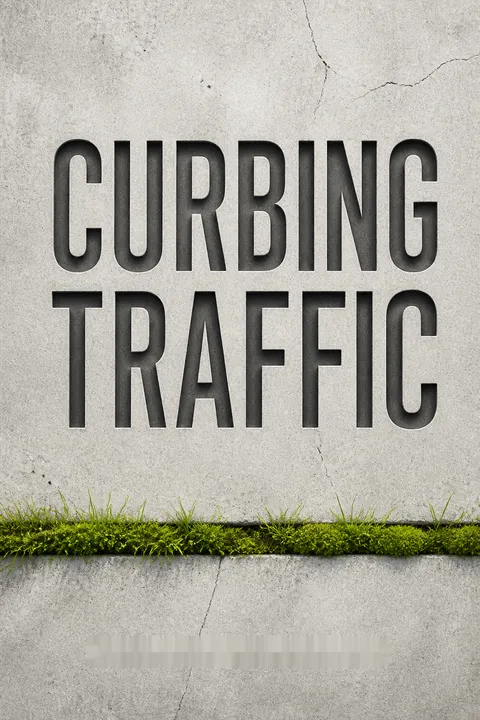
Curbing Traffic makes a persuasive case that transport choices shape far more than travel time. Its central move is to treat streets as social and health infrastructure: the same traffic-calming decisions that help a child reach school can also reduce noise, support a disabled resident's independence, and make neighborhood contact more likely. The book's ten city portraits give this argument human scale. A Dutch family story, a resident with multiple sclerosis, and an older neighbor turn abstract planning choices into lived consequences.
The strongest evidence comes from linking policy history to observable outcomes. Delft's circulation plan, woonerf experiments, and cycling network show that low-car environments were built through deliberate decisions, not a national preference that appeared spontaneously. The authors also draw on studies of street sociability, noise, children's travel, and accessibility. These sources reinforce one another, although they vary in design and strength. A case study can illuminate mechanisms, but it cannot prove that a single street treatment caused every reported benefit.
That limitation matters when exporting the model. Delft's compact form, public transport, institutional capacity, and decades of investment are not universal. A city cannot reproduce its outcomes by painting a cycle lane while leaving unsafe crossings, poor service, and distant destinations untouched. The book's more transferable lesson is its systems approach: manage car traffic, provide credible alternatives, design for varied users, and measure trips people currently cannot make.
The argument also has a distributional edge. Removing car priority is not automatically equitable if disabled people, shift workers, rural residents, or low-income households lose access without gaining usable alternatives. The book's strongest examples address this by combining infrastructure with mobility aids, transit, and public engagement. Its vision is therefore not simply fewer cars. It is a city in which access to opportunity does not depend on owning one, and public space reflects the needs of people who live there.
Review Summary
Curbing Traffic receives overwhelmingly positive reviews, praised for its compelling arguments against car-centric urban design. Readers appreciate the authors' personal experiences in Delft, Netherlands, and the book's exploration of how reducing car dependency can improve health, safety, social connections, and equity. Many reviewers express a desire to live in similar car-lite environments. Some criticisms include redundancy, lack of technical depth, and limited applicability to larger cities. Overall, the book is seen as eye-opening and potentially life-changing for those interested in sustainable urban planning.
People Also Read





Glossary
autoluw
Low-car urban policyA Dutch term meaning low-car or nearly car-free. In the book, it describes an approach that restricts the volume, speed, or access of motor vehicles so streets and public spaces can serve walking, cycling, transit, commerce, and social life. It does not require eliminating every vehicle.
backseat generation
Children chauffeured between activitiesA term used by urban geographer Lia Karsten for children whose movement is organized and supervised by adults, often by car. Their daily lives connect home, school, and activities as separate destinations, rather than allowing them to explore and travel through their neighborhood independently.
filtered permeability
Routes open to people, not through-carsA street-network design that prevents motor vehicles from using local streets as shortcuts while keeping routes direct for people walking or cycling. By filtering through traffic rather than closing every street, it can make neighborhood travel safer and more convenient without blocking local access.
woonerf
Shared residential living streetA Dutch living-street design that gives residents, pedestrians, and children priority in shared public space while allowing cars to enter under strict limits. Features may include low vehicle speeds, winding paths, reduced parking, landscaping, and seating. Its purpose is to make a residential street usable as a place to gather, not just pass through.
Sustainable Safety
Dutch road-safety design principlesA Dutch road-safety framework that organizes streets by function and seeks to prevent conflicts, make road users' behavior predictable, and reduce the consequences of human error. The book emphasizes forgiveness, meaning mistakes are less likely to cause severe harm, and predictability, meaning street design makes others' movements easier to anticipate.
mobilities of care
Travel linked to unpaid careA planning term for the journeys associated with unpaid care and household responsibilities, including school drop-offs, shopping, and appointments. These trips often involve short distances, multiple stops, and travel outside conventional commute hours. Recognizing them helps planners account for travel patterns that standard surveys can overlook.
CROW Design Manual for Bicycle Traffic
Dutch cycling-network design guideA Dutch national design manual developed to guide bicycle infrastructure and network planning. It evaluates routes through cohesion, directness, safety, attractiveness, and comfort. The book presents its guidance as useful beyond conventional cycling, since connected, smooth, and accessible routes can also serve people using mobility aids and other devices.
spatial mismatch
Homes separated from opportunityA term for the separation between where people live and where jobs or essential services are located. The book discusses it in relation to racial and economic inequality: when employment moves beyond the reach of residents who lack cars or reliable transit, their access to work and economic mobility can decline.
comprehensive resilience in transportation
Recoverable, reliable, sustainable travelA transportation quality defined in the book as the capacity to recover from disruption, provide reliable travel, and remain sustainable. It depends on offering diverse ways to move rather than relying on a single dominant mode. A resilient network can keep daily life functioning when roads, fuel supplies, or public transport are disrupted.
aging in place
Growing older in one's communityThe ability to remain in one's home or neighborhood as one grows older, for as long as possible, while retaining access to daily needs, social contact, and meaningful activity. It depends not only on housing, but also on nearby services, safe routes, public transport, places to rest, and a supportive community.
Download PDF
Download EPUB
.epub digital book format is ideal for reading ebooks on phones, tablets, and e-readers.